|
ILCI
of Todi (Pg-Italy)
History
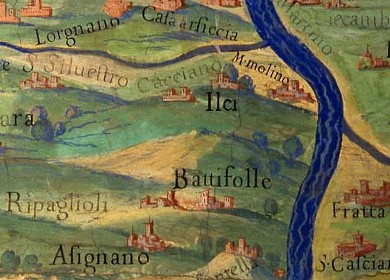
Detail of the fresco
depicting Umbria fregion rom the Gallery of Maps located in the
Vatican
Museums.
Painted between 1580
and 1583 on the basis of drafts painted by the perugian
Ignazio Danti, one of the greatest geographers of the time,
requested by Pope Gregory XIII
-Vatican
Museums Photo
SEE
FULL SIZE PICTURE ©Musei
Vaticani
|
|
 |
see
historical traces found in the municipal archives of Todi (edited by
F. Orsini)
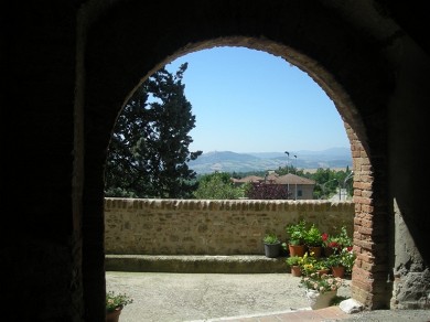
The most documented
historical period is undoubtedly the medieval one.
The village, despite some badly corrected interventions, preserves
the medieval structure and
atmosphere, such as the voltans and some very suggestive alleys.
on the
left "Il Voltone"
|
|
In 1310 the Guelphs of
Perugia "put their lodgings there and fortified the village" in the
battle against the Ghibellines of Todi, near Montemolino where the Duke
of Spoleto and other nobles died. In 1311, the Ghibellines of Todi
besieged the castle and entered it bringing death and damage (as written
in some
"Documenti tratti dall'archivo segreto del Comune di Todi"
'secret documents of the archives of Todi')
About a century later, in 1444, Ilci was attacked again by the
ghibelline Niccolò
Piccinino and burned down.
|
N.
Piccinino - PORTRAIT 
|
|
___________________________________
|
|
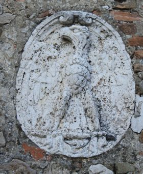
The eagle (the emblem of Todi) above "the voltone" |
Having
been almost completely destroyed, it obtained a ten-year immunity in
order to be rebuilt. Subsequently, it was for a long time a fief of the
noble Oddi family.
 Arms ODDI
Fam. Arms ODDI
Fam.
In 1620
Paolo degli Oddi obtained the possibility of building a lintel over the
main door which, had already the effigy of the eagle, the emblem of
Todi, (approved by the municipal resolution of 1573) and where it still
stands today.
|
|
GREGORIAN LAND REGISTRY
Map of Ilci from the Gregorian land registry *
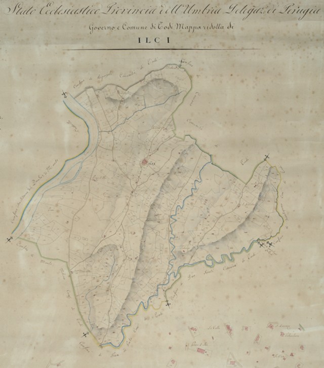
It is the first cadastre of the entire Papal State,
promoted by Pio VII in 1816 and activated by Gregory XVI in 1835. It was
carried out by the Censo's General Presidency, according to the
procedures already adopted during the former Kingdom of Italy by the
Napoleonic register in the Legations (Bologna and the Romagne) and in
the Marche Region. A copy was kept at the Cancellerie del Censo. It
includes three related series: the maps (1: 2000), the small scale
mappettes (1: 4000 or 1: 8000), the owners' registers (brogliardi or
sommarioni). The copy kept at the State Archives of Rome is, more
complete, original and less deteriorated than the one kept in the local
area, which has often been altered over the years. The cartography
offers the most complete picture available on the territorial and urban
layout of the papal province.
|
|
___________________________________
|
|
Immages by Andrea Ceccarini
|